LINKS
Life Without Limbs
Nick Vujicic
Lynda Randle
Ministries
Windows of Hope
Gospel for Asia
Highway of Tears
Bill Gaither Ministries
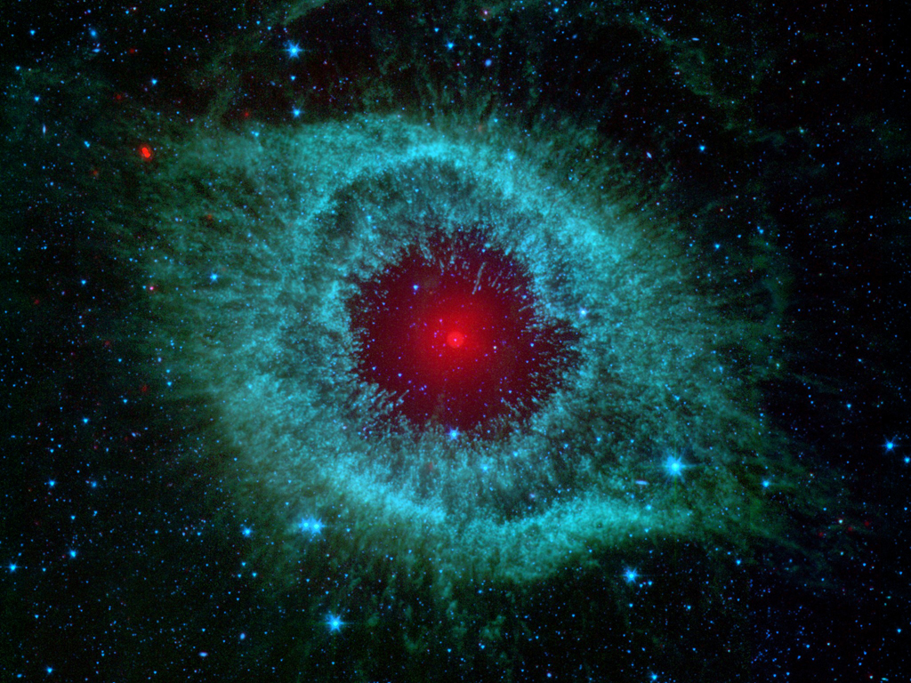
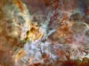
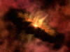
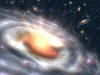
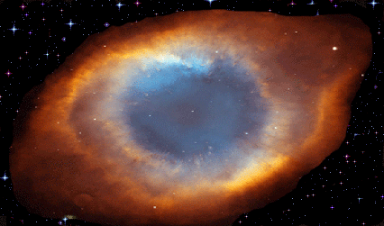
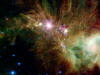
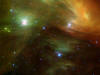
Click
on
Pictures
To Enlarge
Go to
NASA
Website
For Description


The 'Terrible Twos'

Aglo


God's
Perfect
Sight
|
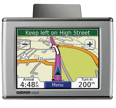
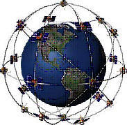
What is a GPS
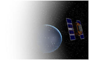
The Global Positioning System (GPS) is a satellite-based
navigation system made up of a network of 24 satellites placed into
orbit by the U.S. Department of Defense. GPS was originally intended for
military applications, but in the 1980s, the government made the system
available for civilian use. GPS works in any weather conditions,
anywhere in the world, 24 hours a day. There are no subscription fees or
setup charges to use GPS.
How it works
GPS satellites circle the earth twice a day in a very
precise orbit and transmit signal information to earth. GPS receivers
take this information and use triangulation to calculate the user's
exact location. Essentially, the GPS receiver compares the time a signal
was transmitted by a satellite with the time it was received. The time
difference tells the GPS receiver how far away the satellite is. Now,
with distance measurements from a few more satellites, the receiver can
determine the user's position and display it on the unit's electronic
map.
A GPS receiver must be locked on to the signal of at
least three satellites to calculate a 2D position (latitude and
longitude) and track movement. With four or more satellites in view, the
receiver can determine the user's 3D position (latitude, longitude and
altitude). Once the user's position has been determined, the GPS unit
can calculate other information, such as speed, bearing, track, trip
distance, distance to destination, sunrise and sunset time and more.
How accurate is GPS?
Today's GPS receivers are extremely accurate, thanks to
their parallel multi-channel design. Garmin's 12 parallel channel
receivers are quick to lock onto satellites when first turned on and
they maintain strong locks, even in dense foliage or urban settings with
tall buildings. Certain atmospheric factors and other sources of error
can affect the accuracy of GPS receivers. Garmin® GPS receivers are
accurate to within 15 meters on average.
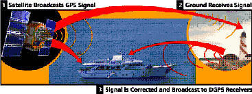
Newer Garmin GPS receivers with
WAAS (Wide Area Augmentation
System) capability can improve accuracy to less than three meters on
average. No additional equipment or fees are required to take advantage
of WAAS. Users can also get better accuracy with Differential GPS (DGPS),
which corrects GPS signals to within an average of three to five meters.
The U.S. Coast Guard operates the most common DGPS correction service.
This system consists of a network of towers that receive GPS signals and
transmit a corrected signal by beacon transmitters. In order to get the
corrected signal, users must have a differential beacon receiver and
beacon antenna in addition to their GPS.
The GPS
satellite system
The 24 satellites that make up the GPS space segment are
orbiting the earth about 12,000 miles above us. They are constantly
moving, making two complete orbits in less than 24 hours. These
satellites are travelling at speeds of roughly 7,000 miles an hour.
GPS satellites are powered by solar energy. They have
backup batteries onboard to keep them running in the
event of a solar eclipse, when there's no solar power.
Small rocket boosters on each satellite keep them flying
in the correct path.
Here are some other interesting facts about the GPS
satellites (also called NAVSTAR, the official U.S. Department of Defense
name for GPS):
The first GPS satellite was launched in 1978.
A full constellation of 24 satellites was achieved in
1994.
Each satellite is built to last about 10 years.
Replacements are constantly being built and launched into orbit.
A GPS satellite weighs approximately 2,000 pounds and
is about 17 feet across with the solar panels extended.
Transmitter power is only 50 watts or less.
What's the signal?
GPS satellites transmit two low power radio signals,
designated L1 and L2. Civilian GPS uses the L1 frequency of 1575.42 MHz
in the UHF band. The signals travel by line of sight, meaning they will
pass through clouds, glass and plastic but will not go through most
solid objects such as buildings and mountains.
A GPS signal contains three different bits of information
— a pseudorandom code, ephemeris data and almanac data. The pseudorandom
code is simply an I.D. code that identifies which satellite is
transmitting information. You can view this number on your Garmin GPS
unit's satellite page, as it identifies which satellites it's receiving.
Ephemeris data tells the GPS receiver where each GPS
satellite should be at any time throughout the day. Each satellite
transmits ephemeris data showing the orbital information for that
satellite and for every other satellite in the system.
Almanac data, which is constantly transmitted by each
satellite, contains important information about the status of the
satellite (healthy or unhealthy), current date and time. This part of
the signal is essential for determining a position.
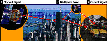
Sources of GPS signal errors
Factors that can degrade the GPS signal and thus affect
accuracy include the following:
Ionosphere and troposphere delays — The satellite
signal slows as it passes through the atmosphere. The GPS system
uses a built-in model that calculates an average amount of delay to
partially correct for this type of error.
Signal multipath — This occurs when the GPS signal is
reflected off objects such as tall buildings or large rock surfaces
before it reaches the receiver. This increases the travel time of
the signal, thereby causing errors.
Receiver clock errors — A receiver's built-in clock
is not as accurate as the atomic clocks onboard the GPS satellites.
Therefore, it may have very slight timing errors.
Orbital errors — Also known as ephemeris errors,
these are inaccuracies of the satellite's reported location.
Number of satellites visible — The more satellites a
GPS receiver can "see," the better the accuracy. Buildings, terrain,
electronic interference, or sometimes even dense foliage can block
signal reception, causing position errors or possibly no position
reading at all. GPS units typically will not work indoors,
underwater or underground.
Satellite geometry/shading — This refers to the
relative position of the satellites at any given time. Ideal
satellite geometry exists when the satellites are located at wide
angles relative to each other. Poor geometry results when the
satellites are located in a line or in a tight grouping.
Intentional degradation of the satellite signal —
Selective Availability (SA) is an intentional degradation of the
signal once imposed by the U.S. Department of Defense. SA was
intended to prevent military adversaries from using the highly
accurate GPS signals. The government turned off SA in May 2000,
which significantly improved the accuracy of civilian GPS receivers.
Now See
God's
Perfect
Sight
|
|
LOOKING FOR A
GPS? - SEE
IRL SUPPLIES
WEBSITE |
God's
Perfect
Sight

|
LINKS
World Renew
Mennonite Central
Committee
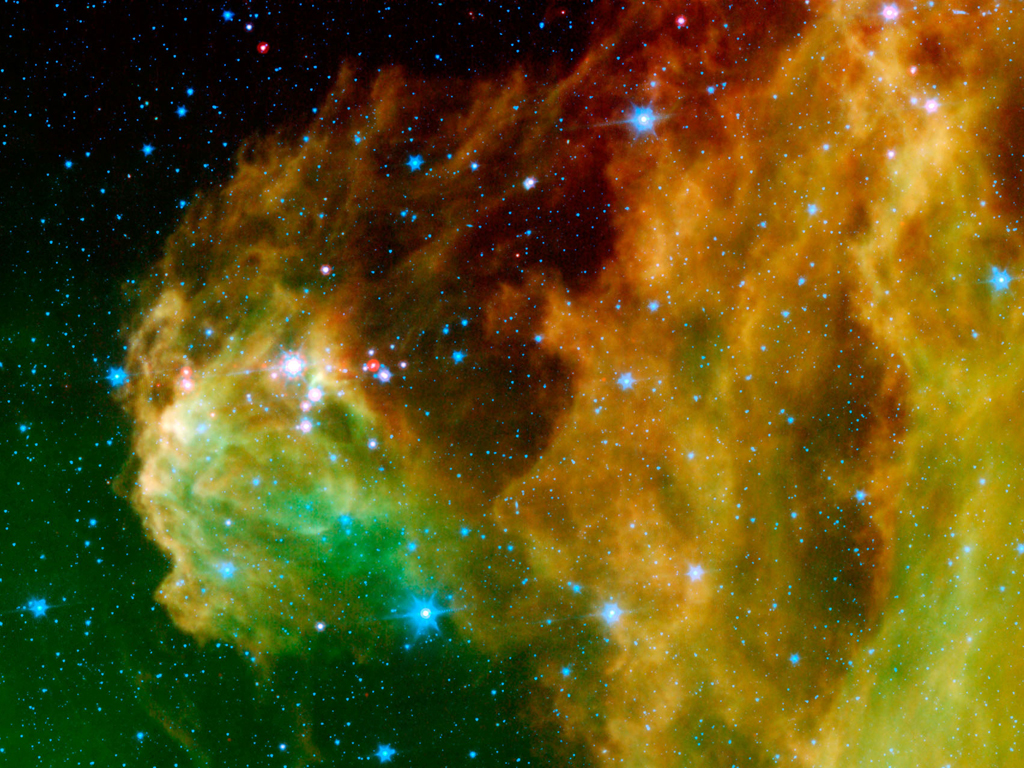
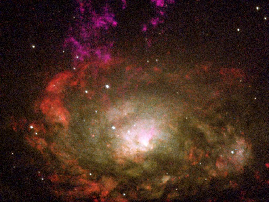
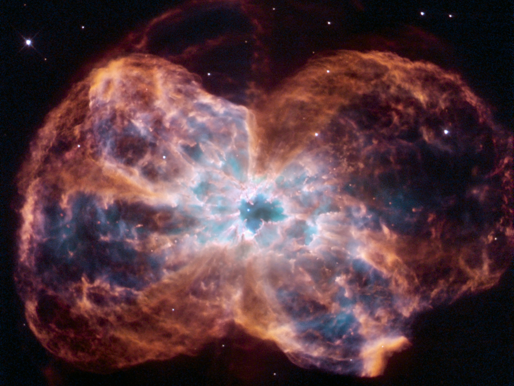
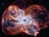
Click
on Pictures
To Enlarge
Go to
NASA
Website
For Description

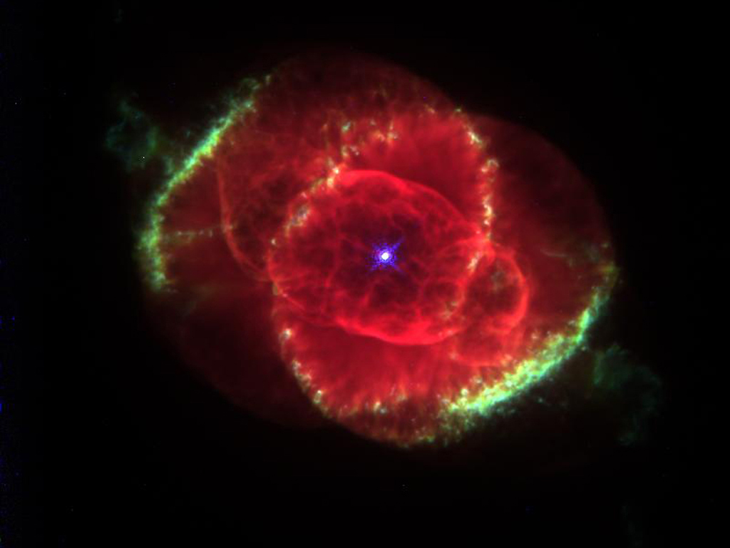
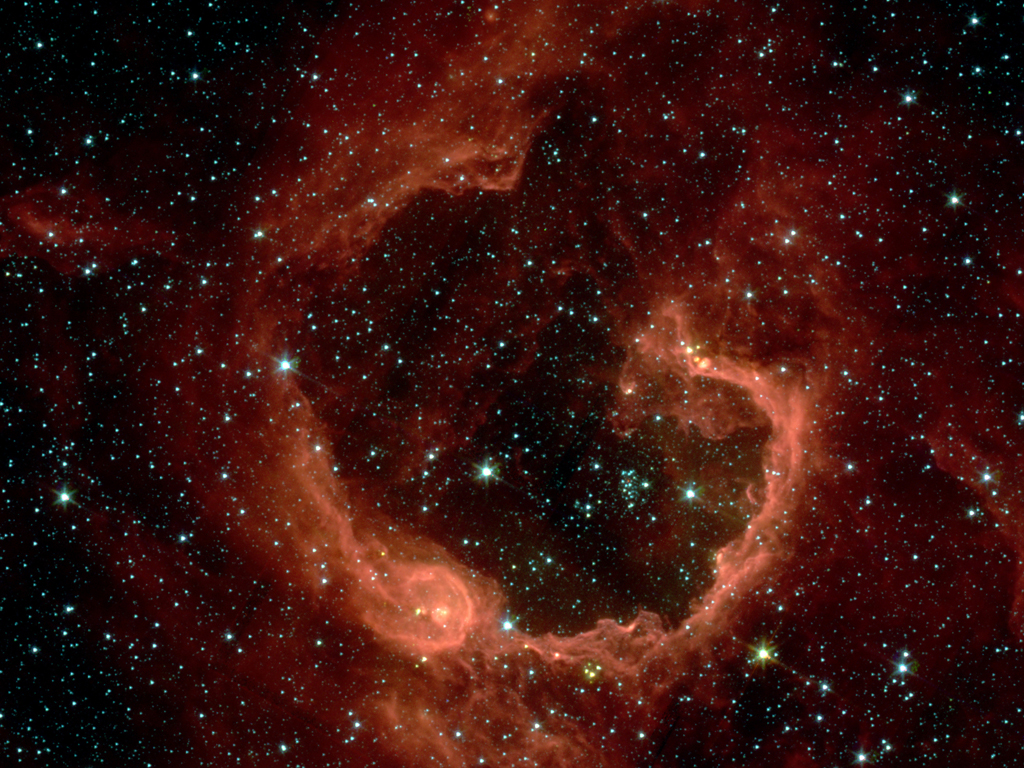
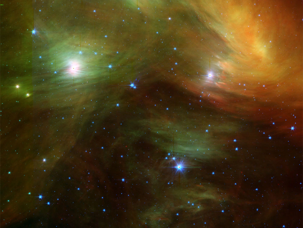
A Classic Beauty


Timeless Beauty

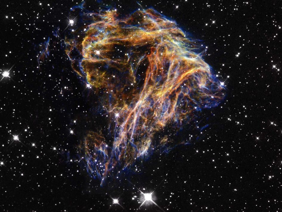
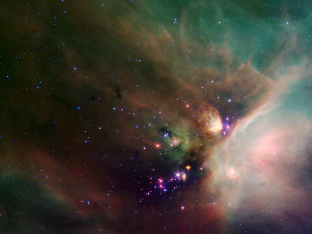
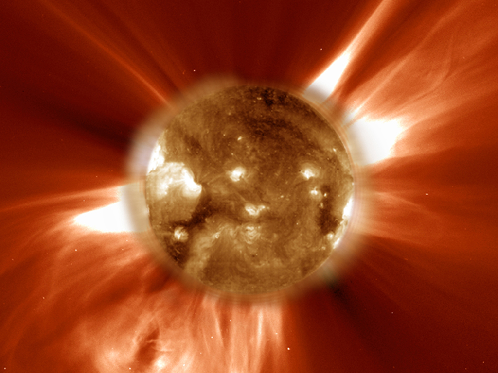
Cosmic Zoom Lens
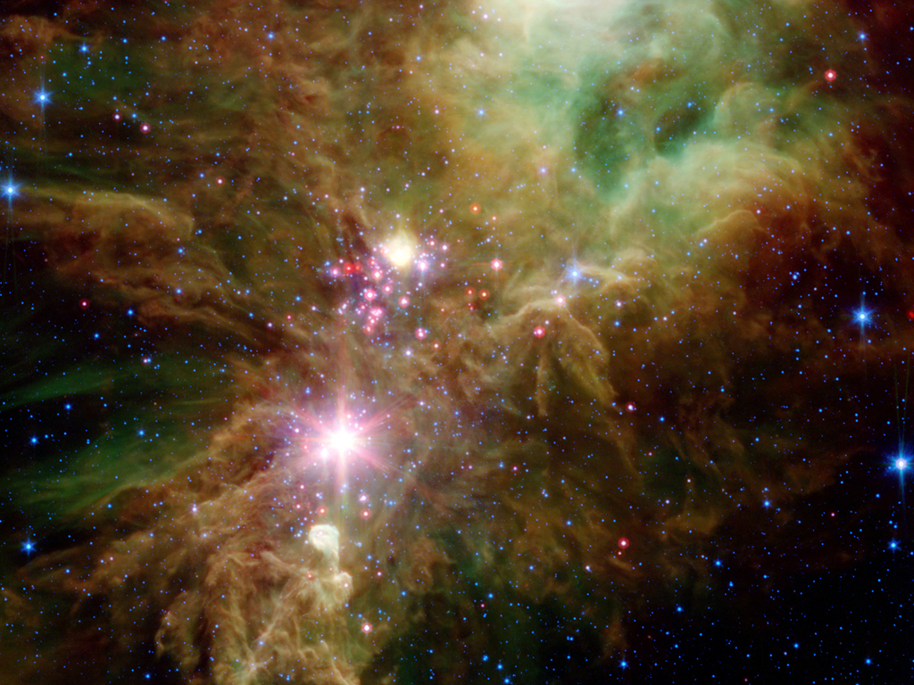
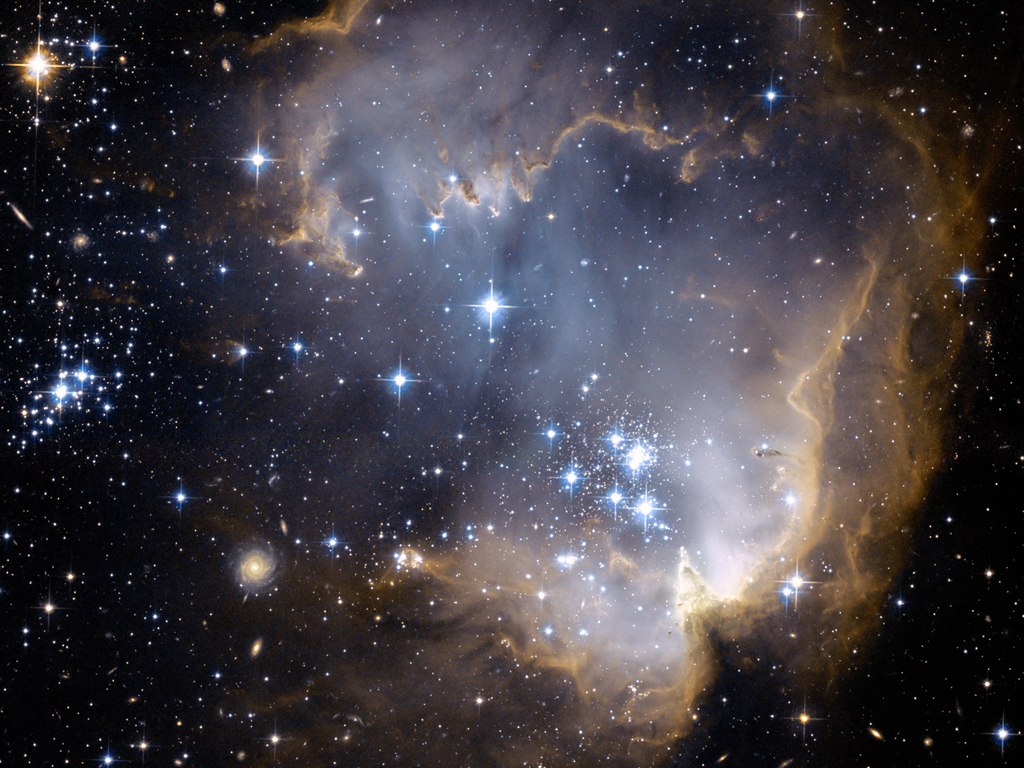
Snowflakes in the
Universal Sky
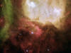
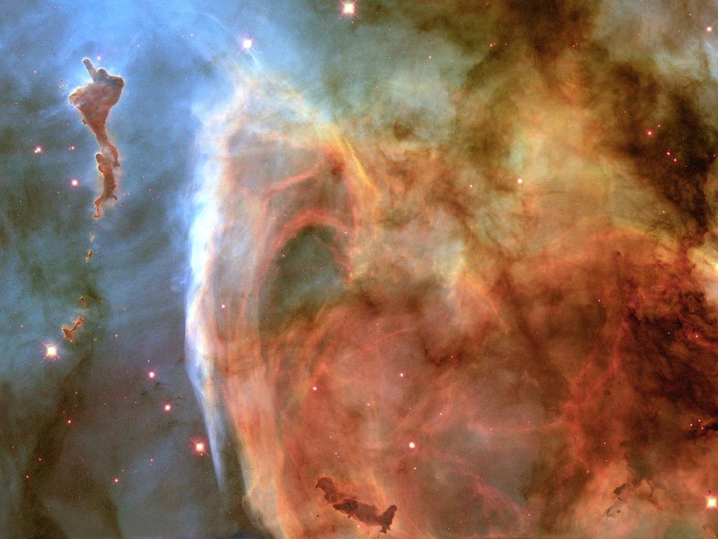
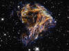
Ghost Head Nebula


God's
Perfect
Sight
|